Eigentlich wollte ich an eine Stelle, an der der Graben sichtbar ist. Ok – es ist kein Graben so wie wir uns das vielleicht vorstellen. Es ist die Stelle, an der zwei große Kontinentalplatten zusammentreffen – die nordamerikanische und die pazifische Platte, und zu dieser Verwerfung führen, dem San Andreas Graben. Im Carrizo Plain National Monument in Zentralkalifornien gibt es eine Stelle, wo man das gut sehen kann. Im Jahr meines Besuchs (2018) kam der Frühjahrsregen leider sehr spät, so dass ich mit meinem Pkw nicht dahin fahren konnte. Und so seht Ihr einige Bilder des Carrizo Plain und eben den unsichtbaren Graben.
English Summary
The Invisible Fault
Actually, I wanted to go to a place where the trench is visible. Ok – it’s not a trench as we might imagine it. It’s the place where two major continental plates meet – the North American plate and the Pacific plate, and lead to this fault, the San Andreas Fault. In Carrizo Plain National Monument in Central California, there is a spot where you can see this clearly. Unfortunately, in the year I visited (2018), the spring rains came very late, so I couldn’t drive my car there. And therefore you see some pictures of the Carrizo Plain and just the invisible fault.
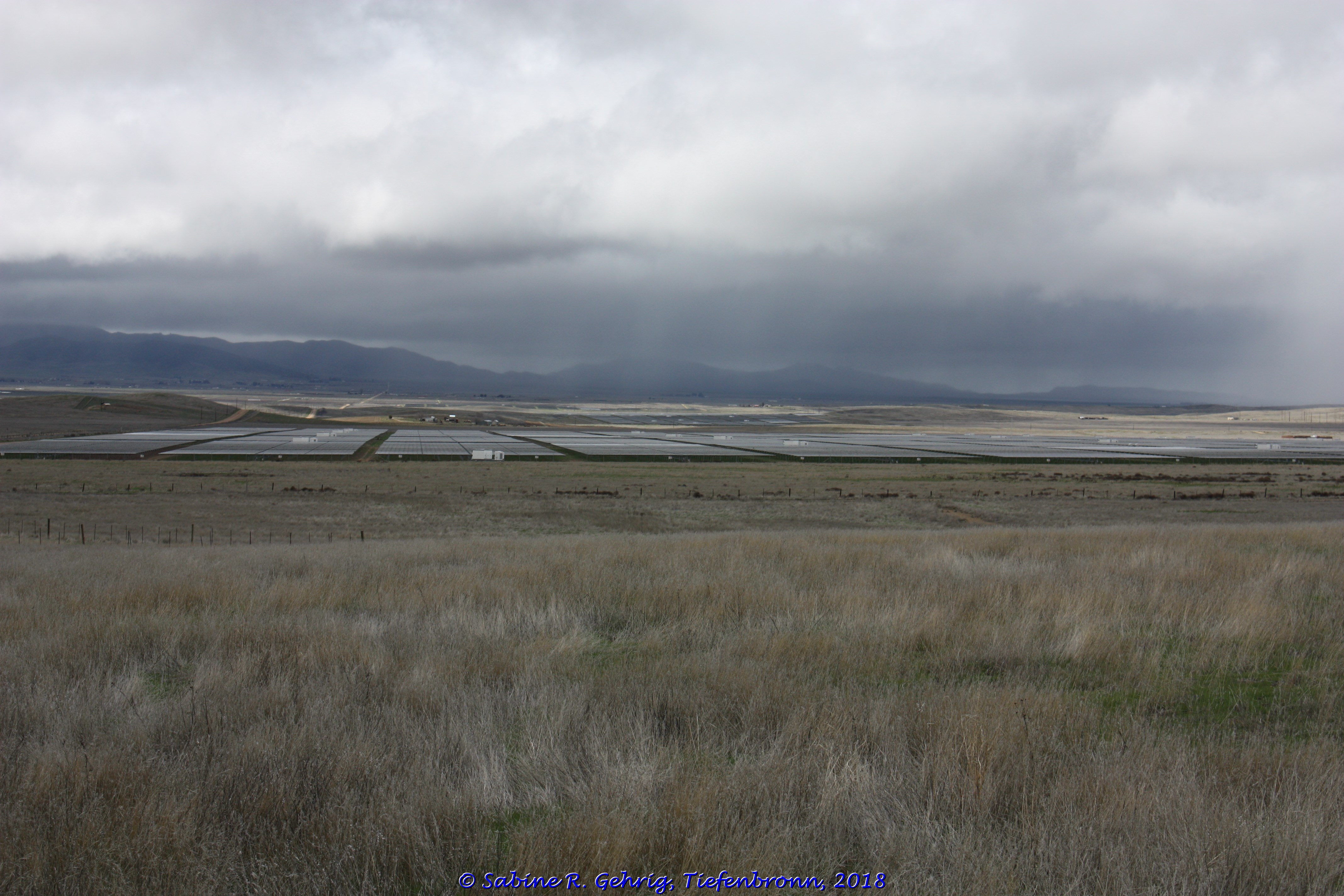
Carrizo Plain National Monument, Kalifornien, USA – Blick auf die alte Mine / View of the old mineCarrizo Plain National Monument, Kalifornien, USA – Blick auf den 12 km² großen Soda Lake, der die tiefsten Stellen der abflusslosen ca. 80 km langen und 24 km breiten Ebene füllt; im Hintergrund die Tremblor Range, vor der sich der San Andreas Graben befindet. / View of the 3,000 acres Soda Lake, which is the deepest part of the drainageless plain which is approximately 50 mi long and 15 mi wide; in the background is the Tremblor Range, fronted by the San Andreas Fault.Carrizo Plain National Monument, Kalifornien, USA – Blick über Soda Lake und die Ebene, die mit 998,81 km² größte heute noch zusammenhängende Grasfläche Kaliforniens, von dem das National Monument ein Teil ist / View over Soda Lake and the Plains, the largest contiguous grassland in California today at 246,812 acres, of which the National Monument is a partCarrizo Plain National Monument, Kalifornien, USA – Der unsichtbare Graben verläuft am Fuß des linken Hügels und dann zwischen den beiden Hügeln in der Bildmitte durch / The San Andreas Fault runs at the foot of the left hill and then between the two hills in the center of the picture throughCarrizo Plain National Monument, Kalifornien, USA – Die Solarpanels der California Valley Solar Ranch, einer ca. 7,96 km² großen Solaranlage, die im Oktober 2013 in Betrieb genommen wurde / The solar panels at the California Valley Solar Ranch, an approximately 1,966 acres solar facility that became operational in October 2013


Nice Sabine; luckily I was there a year after you and it was bone dry so I was able to get up to Wallace Creek where you can clearly see the offset.
Sometimes you just have to be lucky… https://pbase.com/jfp_photo/2019_ca_carrizo_plain_nm
Take Care!
Jerry
LikeLike